Landslide Susceptibility AI
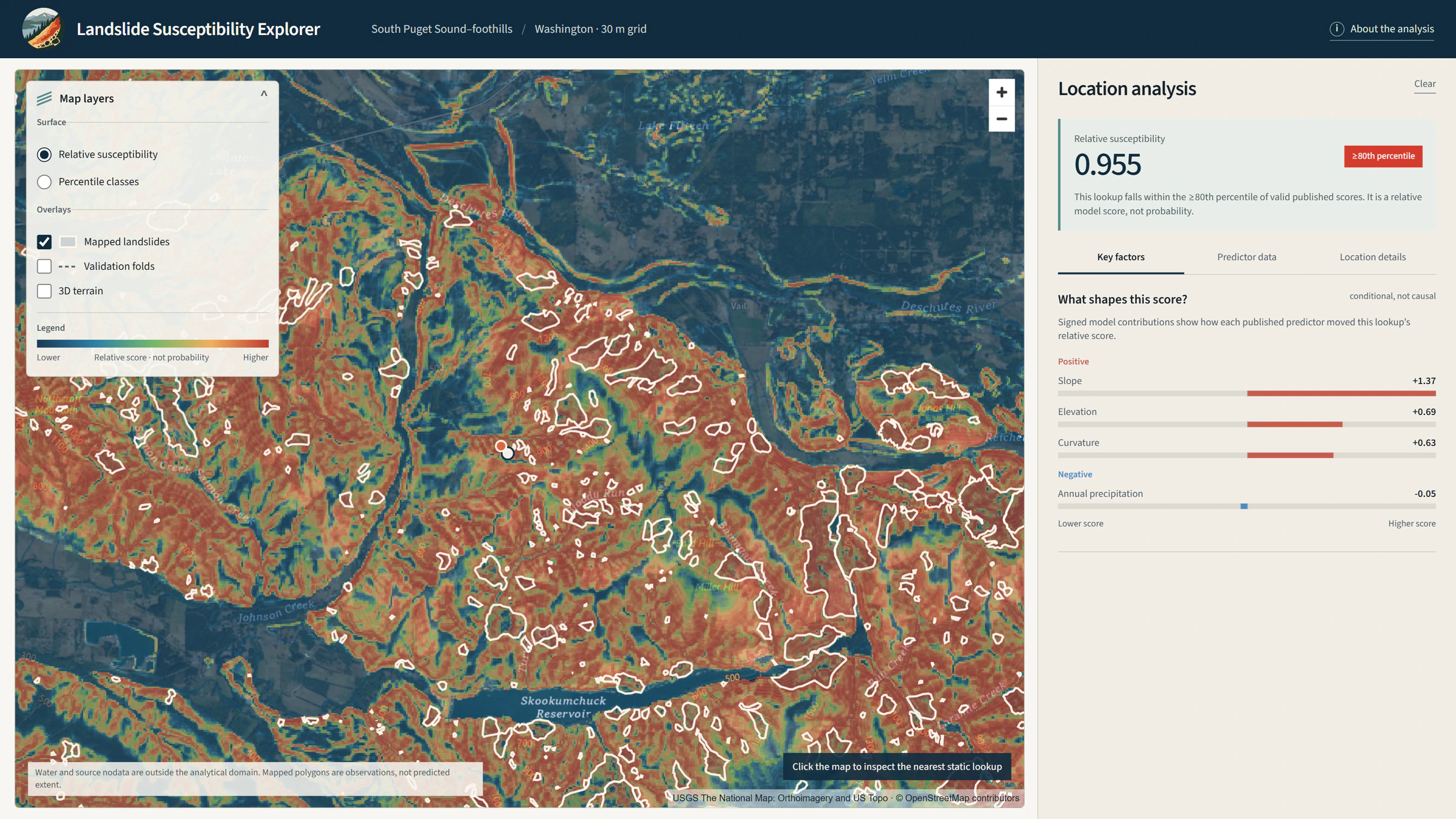
A geospatial machine-learning project for mapping relative landslide susceptibility and exploring which terrain and environmental variables are influencing the model.
The question
How can terrain and environmental predictors be combined to explore relative landslide susceptibility across the Puget Sound foothills?
Approach
The workflow combines elevation, slope, aspect, terrain curvature, distance to hydrography, land cover and precipitation normals with a mapped landslide inventory and spatially structured modelling data. It compares a logistic regression baseline with an XGBoost primary model, uses spatial validation and supports interpretation of contributing factors.
Deliverable
An interactive model-exploration application for reviewing susceptibility outputs, predictor context and contributing-factor interpretation.
Technical implementation
Python-based spatial data preparation and modelling, including terrain and environmental predictors, logistic regression, XGBoost, spatial validation and explainability, delivered through interactive web mapping.
Data
- Mapped landslide inventory
- Terrain derivatives
- Hydrography
- Land cover
- Precipitation normals
Limitations / methodology note
This is susceptibility screening and model exploration, not deterministic prediction or an operational hazard warning. Results depend on the inventory, predictor data and modelling choices.
Have a similar question?
Get in touch