3D Flood Exposure Explorer
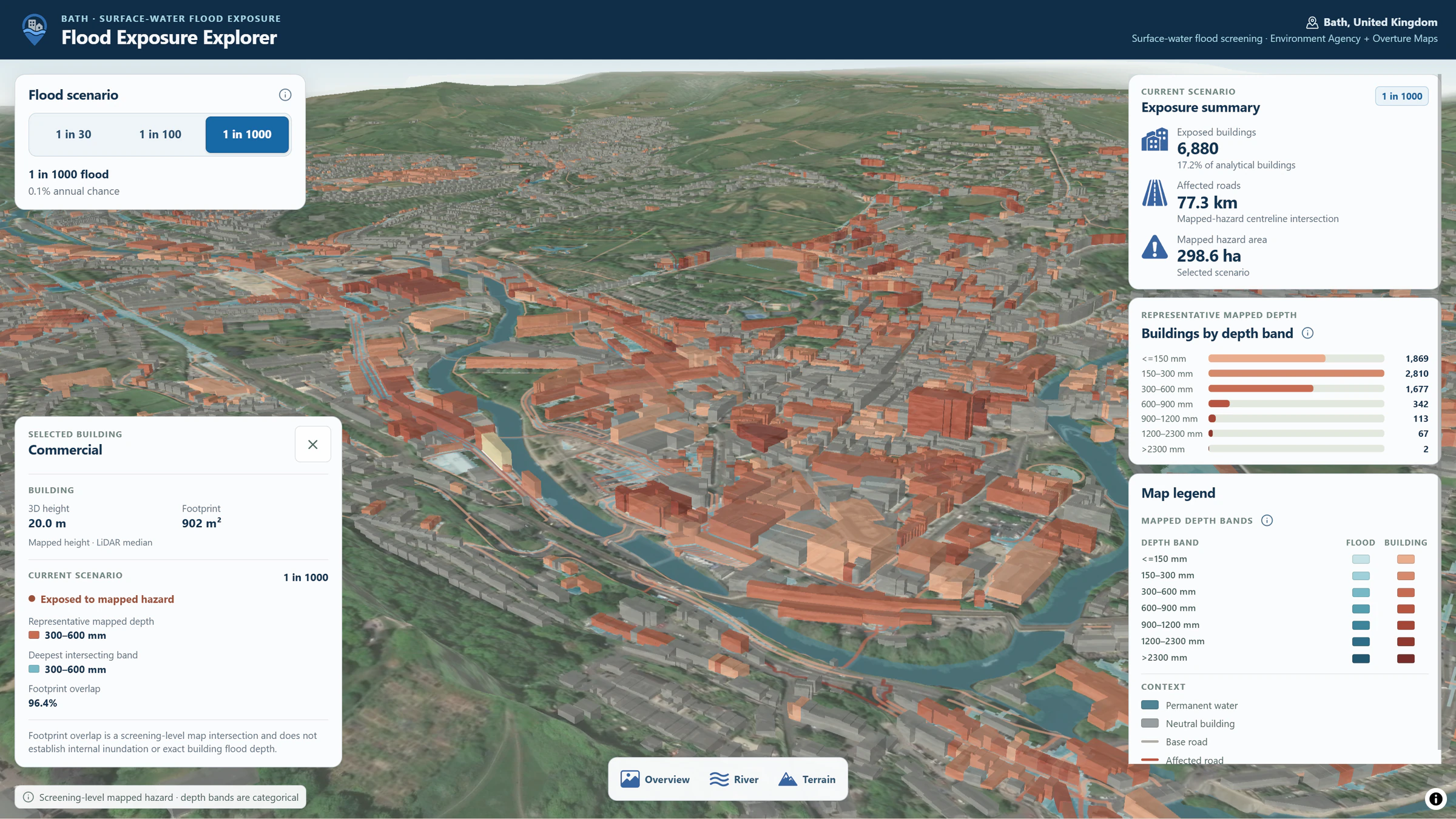
An interactive 3D application for seeing which buildings and roads intersect surface-water flood hazard under different scenarios in Bath, UK.
The question
How can planners and resilience teams quickly understand which buildings and roads are exposed under different surface-water flood scenarios?
Approach
The project uses Environment Agency surface-water hazard data normalized into seven categorical depth bands. Analysis is performed in EPSG:27700, with building footprints and road centrelines intersected against the hazard polygons. A building is exposed with at least 1 m² of meaningful footprint overlap, while a road segment is exposed with at least 1 m of meaningful centreline overlap. For exposed features, the representative band is the depth category covering the largest meaningful intersection, while the deepest band records the deepest category touched.
Deliverable
The application supports 1-in-30, 1-in-100 and 1-in-1000 surface-water scenarios, 3D terrain, 3D building footprints, mapped building and road exposure, hazard-area summaries, building counts by representative depth band, direct building inspection and Overview, River and Terrain camera presets. It demonstrates a path from hazard data through exposure analysis and performance-aware geospatial delivery to intuitive 3D exploration.
Technical implementation
Analysis and processing use Python for geospatial vector/raster processing in an EPSG:27700 workflow. The TypeScript/Vite frontend uses MapLibre GL JS. Browser-ready geospatial datasets are delivered as static PMTiles archives using HTTP Range requests, with scenario statistics kept static for responsive exploration.
Data
- Environment Agency surface-water hazard data
- Environment Agency 2 m DTM / DSM
- Overture Maps buildings
- Overture Maps transportation
- Ordnance Survey OS OpenMap–Local permanent-water context
Limitations / methodology note
This is a screening-level exposure product. It does not establish exact property inundation, internal flood depth, flood damage, road passability or safety.
Have a similar question?
Get in touch