Landscape Restoration Prioritizer
An interactive screening tool for finding and comparing areas in Skåne that may warrant a closer look for ecological restoration.
The question
Where should a conservation organization investigate ecological restoration opportunities first, and why?
Approach
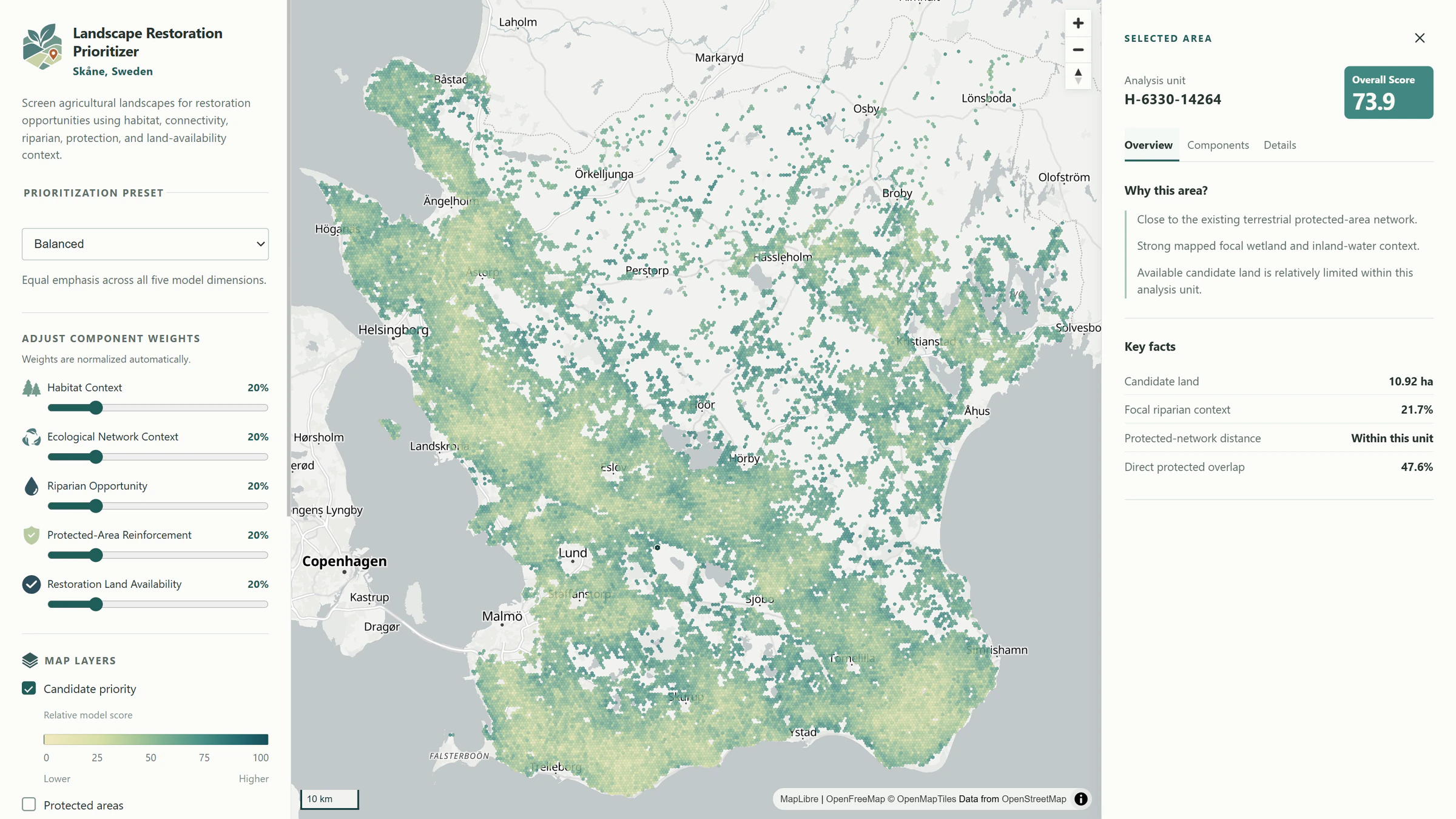
The project explores how regional environmental datasets can be combined into a transparent screening model to identify locations worth investigating for ecological restoration. The model evaluates eligible 500 m hexagons across Skåne using five components: habitat context, ecological network context, riparian opportunity, protected-area reinforcement and restoration land availability. Each component is converted to a relative 0–100 score across the eligible candidate population, then combined through predefined prioritization presets or user-adjustable weights. This is regional screening rather than parcel-level restoration advice; the prioritization is relative and supports investigation rather than claiming ecological feasibility.
Deliverable
The live application includes three prioritization presets, adjustable component weights, a ranked Top Candidates shortlist, protected-area and wetland/inland-water context, interactive candidate inspection and an explanation of how each analysis unit scores. It demonstrates a path from environmental source data through reproducible spatial analysis and a decision-support model to an interactive map product.
Technical implementation
Processing and analysis use Python with GeoPandas, Rasterio, Shapely, PyProj, NumPy and pandas. The frontend uses React, TypeScript, MapLibre GL JS and Vite, deployed through Cloudflare Pages.
Data
- SCB DeSO 2025 boundaries
- Naturvårdsverket NMD2023 Basskikt v2.1
- Naturvårdsverket protected areas
- Natura 2000
Limitations / methodology note
This is a regional screening model. Scores are relative to the eligible candidate population, not ecological probabilities. A high ranking does not demonstrate restoration feasibility; land ownership, permissions and field conditions are outside the model.
Have a similar question?
Get in touch