Infrastructure Corridor Optimizer
An interactive routing study that compares plausible infrastructure corridors under different trade-offs between distance, terrain and environmental constraints.
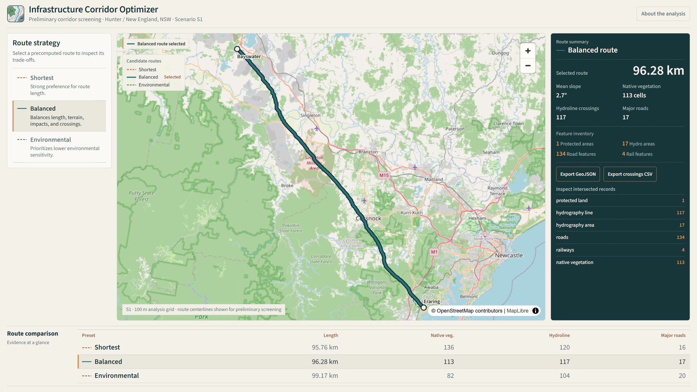
The question
How can early-stage infrastructure corridor options be compared transparently under different distance, terrain and environmental constraints?
Approach
The application evaluates routes between fixed endpoints on a 100 m analysis grid using terrain and environmental constraints alongside transport and hydrographic context. A* routing produces three comparable strategies: Shortest, Balanced and Environmental.
Deliverable
An interactive MapLibre application for comparing plausible corridors, reviewing route trade-offs and inspecting impact summaries.
Technical implementation
Python-based spatial preparation and A* route analysis on a constrained grid, with interactive MapLibre delivery of route alternatives, context layers and comparison summaries.
Data
- Terrain
- Environmental constraints
- Transport context
- Hydrographic context
Limitations / methodology note
This is early-stage corridor screening and comparison. It does not imply engineering design suitability, detailed constructability or permitting feasibility.
Have a similar question?
Get in touch